Back Home

Start making better decisions today, based on accurate aerial data

Start making better decisions today, based on accurate aerial data

  • Home
  • Services
  • News
  • Contact/Find Us

Rest and be Thankful

Image shows comparison to a previous survey.

LMS Z-620 Ultra Long Range Scanner.

Rest and be thankful measured over 2.5km.

LMS Z-620 2007

With a range of 2.5km how many other companies had this capability in 2007.

The first VZ1000 in the UK

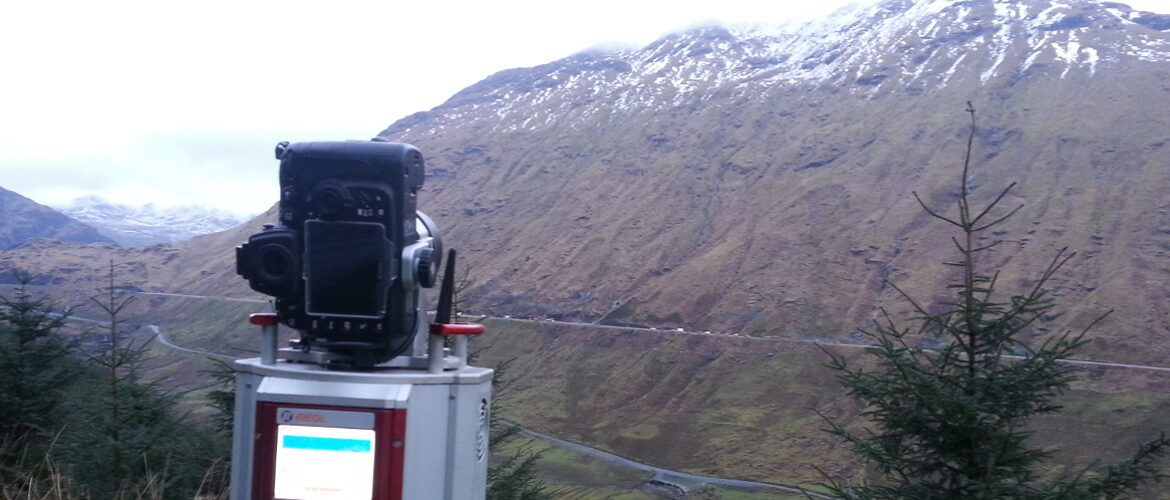
Rest and be thankful.

3D laser scanner pointed towards land for surveying

Riegl VZ1000 Slope Monitoring.

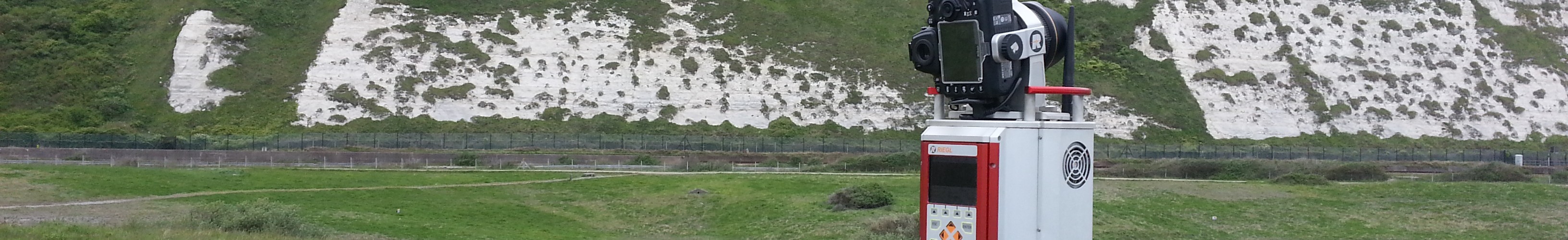
Checking for movement above Railway.

‹
›
Home » Environmental Monitoring » Land Slide Monitoring

Recent Posts

  • SLAM vs VZ400i
  • The Best Topographical Surveys.
  • Photogrammetry or LiDAR
  • Measured Building Surveys.
  • Heritage Site Survey Solutions
  • Forest Mapping.
  • Best SLAM Surveys.
  • Reality Capture
  • Land Surveying Large Sites.
  • Cement Plant Surveys.

Services

  • Aerial Surveys
  • Environmental Monitoring
    • Flood Monitoring
    • Land Slide Monitoring
    • Visual Impact
  • Forest Mapping and Mensuration
  • Highway Surveys
  • Infrastructure Inspection
    • Structural Monitoring
  • Measured Building Surveys
  • Photography and Filming
  • Railtrack and Infrastructure
  • Reality Capture
  • Underground Mapping Services
  • Visual Impact
  • Deep Mine Surveys
  • Development Site Surveys
  • Electricity Grids & Distribution Networks
  • Hydrographic Surveys
  • Landfill
  • Oil & Gas Distribution and Infrastructure
  • Opencast Coal
  • Quarry Surveys
  • Stock Surveys
  • Terrestrial Laser Scan Surveys
  • Topographical Surveying

Land Slide Monitoring


AIMSurveys can use the latest in scanning technology to monitor land slides for good health and safety practice.

Our software can then monitor the displacement during land slides and can identify and measure any slip experienced.

Contact Us:

3, The Bridge Business Centre, Beresford Way, Chesterfield, Derbyshire S41 9FG 01246 268444

RSS AIMSurveys

  • SLAM vs VZ400i
  • The Best Topographical Surveys.
  • Photogrammetry or LiDAR
  • Measured Building Surveys.
  • Heritage Site Survey Solutions
  • Forest Mapping.
  • Best SLAM Surveys.
  • Reality Capture
  • Land Surveying Large Sites.
  • Cement Plant Surveys.

· © 2026 AIMSurveys · Designed by Press Customizr · Powered by ·